Identification and Reference System
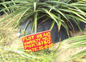
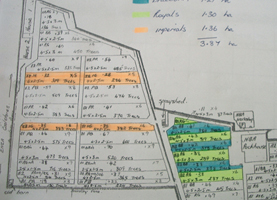
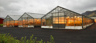
Producers are required to identify all field/orchard, greenhouse/yard/plot/livestock building/pen or other farm area/location. This can be done by putting up signs next to or onto the unit of production itself or alternatively by drawing or using a map or farm plan that identifies and depicts the different units of production. In most cases, names and numbers (can also be varieties, date and year of planting, etc.) are used for this purpose. (AF 1.1.1)

Identifying the production units is necessary to indicate where agricultural activities have taken place or are due to take place. Records on agricultural activities require naming the respective production unit.


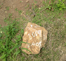
The stone can be accepted as long as it is clearly marked and NOT removed. It is important for the CB inspector to confirm that this system is real and consistent. The inspector must verify whether this signage / reference system is reflected in the plant protection product and fertilizer records, planting records and harvest records and, if a map is also available, whether it correlates with the actual signage.
NOTE: The CB inspector must also check that the information on the visual signs, e.g. in this case the stone, is always legible.
Having only a farm map or plan is acceptable. However, the producer is required to make the farm map readily available to the workers involved with the relevant activities, e.g. plant protection product applications, fertilization, irrigation and harvest.


